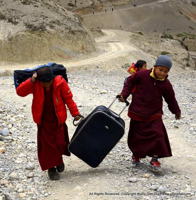
South Col Expeditions had a team of eight trekkers to Mustang and Lo Manthang in April 2015. The first part of the journey is covered in this blog post:
http://www.sujoyrdas.blogspot.in/2015/09/mustang-and-lo-manthang-itinerary-part-i.html This is the second and concluding part.
April 23 2015 |
| Drakmar |
It was a windy and cold morning at Drakmar and we waited for the sun to hit the trail before setting out at 8 am. The trail initially travelled through the village and then entered a canyon with steep walls and amazing rock formations. The trail then started a steep climb to the pass of Mui La 4070m. There were some steep switchbacks and the path finally went through a narrow canyon which opened out onto the pass in about an hour and ten minutes. The trail then traversed a ridge for about 15 min and reached another pass on the other end of the ridge.
 |
| Ghar Gompa from the trail above |
From the second pass the trail dropped steeply to Ghar Gompa which is about an hour from the pass. From the pass the high route to Lo Manthang across the Marangla pass can be seen. Below are the twin villages of Lo Gekar and Marang. The spectacular Ghar Gompa is situated at the end of the valley pressed against the hill side. We left Ghar Gompa around 1 pm and travelled due east down a broad trail to the village of Lo Gekar and then onto Marang in about 45 min. From Marang cross a long suspension bridge and then reach Tsarang in about two hours from Ghar Gompa.
April 24 2015We left Tsarang at 8am and walked down to the river. Cross the river on a bridge and then start the climb up on the other side to a small pass which is reached within one hour. From this pass the trail follows the jeep road climbing slowly until it reaches a large attractive chorten in yellow orange and white at the bottom of a climb in about an hour and a half.
From the chorten the trail climbs up again to another small pass and then again climbs across a large level windswept plain for about another hour until it reaches the last pass. Below lies the walled city of Lo Manthang about forty minutes away. The walk on this day was the hardest of the trek due to the relentless wind, long distances and a long stretch on the jeep able road. Further there is no tea shop anywhere between Tsarang and Lo Manthang.
April 25 2015We had decided the previous evening to go to the Chosser caves in the morning but when we woke up the weather was dark and grim - low clouds hung over the mountains to the north and fresh snows covered the peaks. So instead we stayed at Lo and visited the walled city with its splendid monasteries and frescoes many in need of restoration. The mandala frescoes were particularly outstanding.
 |
| Lo Manthang |
Nearing noon we visited the studio of a tankha painter and while we were there the earthquake struck. Michele, one of our trekkers from Australia who was ill was sleeping in her upstairs room and was helped out by Shyam and our porter Bikram and shell shocked she was put on the road on a mattress. The owner of our lodge Mystic Himalayan Ram Gurung suggested that she be put on oxygen and he hooked her onto to an oxygen cylinder. We did I not know then about the intensity of the earthquake. I tried calling Kathmandu but all lines were busy. Finally on the CDMA sky phone I was able to call Paula who told me that the epicentre was north of Pokhara.
With the quake and Michele's illness we decided to cut short the last day and start our return journey by jeep as planned. We left Lo at around 2pm. There were thirteen of us in a long wheel base Mahindra jeep and it was a very tight squeeze.
 |
| The jeep ride down to Chuksang |
Within half an hour of leaving a rock fall which had occurred due to the landslide blocked the road and Shyam and the porters had to get down and clear the rocks. The weather had also become ominous and a few drops of rain had started to fall. The jeep careered down the darkening hillside the grey brown cliffs of Mustang assuming a monstrous hue. We had planned to reach Chuksang but were told that this jeep would go up to Shyanmochen only.
Just before Shyanmochen the road had become caked in mud and the jeep slipped across a number of times and tethered very close to the edge. We finally all got off and walked up the hill for a short distance to the waiting jeep. We reached a river flowing across the road and had to tranship to another jeep. Finally around 7 pm we reached the Himali guest house in Samar and decided to call it a day. It had been a very long day and we were all exhausted.
We tried to use our phones but all lines were busy and we were unable to reach anyone's phone. We still had no idea about the severity of the earthquake. At around 11 pm there was a knocking on my door. It was Bikram. A phone call from Santaman had conveyed really bad news- Shyam's father had died, their house had collapsed and most of the two hundred houses in the village had been raised to the ground. I went down in the freezing night to find Shyam sitting outside the lodge sobbing loudly. I somehow got him to bed but there was no further sleep for any of us that night. The enormity of this tragedy really hit me then.
April 26th 2015The next morning also dawned ominous and angry. It had again snowed at night and a weak and watery sun was trying to push its way through the clouds. We left for Chuksang around 7 30 am. Fortunately there were no landslides and we entered Chuksang in about 75 minutes.
We had planned to take another jeep to Jomsom but learnt that there was a big landslide ten minutes ahead which had blocked the road. The landslide could not be cleared in the next two hours and finally we crossed the slide on foot. There were jeeps waiting on the other side and we got to Kagbeni in about 45 minutes.
 |
| Crossing a landslide at Chusang |
The final drive to Jomsom took about another hour and dusty, weather beaten and exhausted we entered the Windy Valley Hotel. We then learnt of the severity of the quake and that Kathmandu, many districts in the vicinity had been very badly affected.
April 27th 2015
 |
| At Jomsom below Nilgiri |
We had managed to pre pone our tickets on the Jomsom Pokhara flight and we had been assigned the third flight of the morning at 8.20am. The morning was clear at Jomsom and Niligiri could be seen clearly behind the tarmac. But no flights came that morning. We tried to get a jeep but none of the jeeps were available. Finally around 9.30 am we managed to get a local bus which was going all the way to Pokhara.
 |
| Archana in the bus down to Pokhara |
The dirt track to Pokhara was more suited for a pony than a vehicle. The 74km section to Beni took us seven hours and the final 81 km to Pokhara was covered in around three hours. Dog tired, shaken and exhausted we had completed this bone rattling journey all the way from Lo Manthang at around 3850m through the deep gorge of the Kali Gandaki to Pokhara around 850m in three days. We were lucky to have escaped unscathed.


